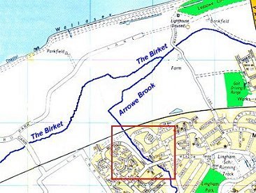
This is to be an on-going project to trace The Wirral's rivers, streams and brooks. Although they are charted on the various larger-scale maps of the area, I decided it would be more fun trying to follow as much as I could myself. And, besides, the exercise will do me good, apparently.
This sudden burst of enthusiasm for the great outdoors was prompted by the persistent heavy rain during Thursday and Friday of last week. These photos show the scary high water in the Arrowe Brook on Friday (5th Sept 2008).
I decided it could be interesting to trace the brook back to its source and follow it to wherever it discharges. I'll use this first page for a bit of a moan about how "neglected" the brook looks but, to be fair, it is usually dredged before the Winter sets in. Maybe a little earlier next year could be a good idea!
My understanding is that our local Council is responsible for trimming the banks but it's DEFRA's job to clear the streams themselves. I have to say, in the main, the banks look ok to me!
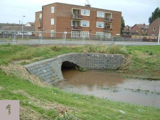

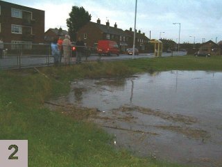 These two photos were taken about 2 hours apart and show how quickly the water reached it's high level at the culvert
under the nearby main road. During a dry spell, there's 6 to 8 feet (200 cm) of headroom above the waterline.
On the first photo here, there's about 4 feet (120 cm) to spare. The second photo shows the water almost above the brickwork with
no headroom at all and only about 4 or 5 inches (10 cm) below the road level by the yellow bus shelter.
These two photos were taken about 2 hours apart and show how quickly the water reached it's high level at the culvert
under the nearby main road. During a dry spell, there's 6 to 8 feet (200 cm) of headroom above the waterline.
On the first photo here, there's about 4 feet (120 cm) to spare. The second photo shows the water almost above the brickwork with
no headroom at all and only about 4 or 5 inches (10 cm) below the road level by the yellow bus shelter.
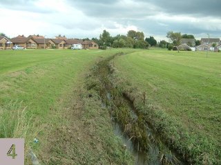
The following week, I decided to take some photos after the water level had dropped to see if anything was impeding the brook's capacity or flowrate (or both).
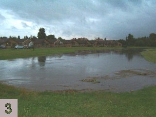
 These two photos are taken from more or less the same spot as the people in the photo above - on the road bridge
looking upstream (to the south).
These two photos are taken from more or less the same spot as the people in the photo above - on the road bridge
looking upstream (to the south).
The photo far left (3) was taken when the water was at its highest. I took the other (4) the following Monday. It seems pretty clear why the water isn't flowing as well as it could.
I'll shortly be adding some pictures of the River Birket, into which the Arrowe Brook flows, and the contrast is immediately obvious.
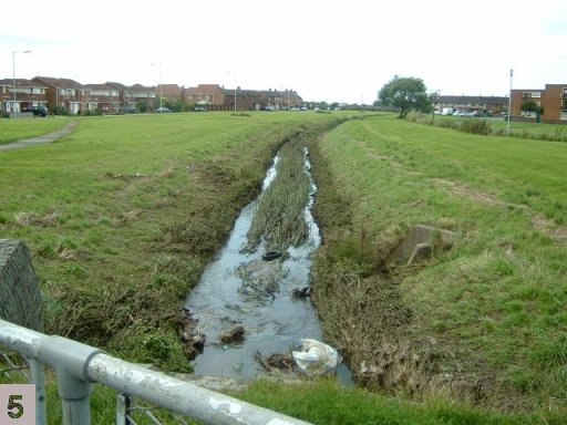
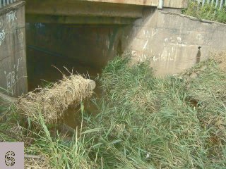
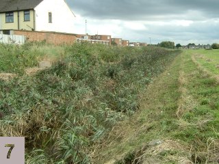
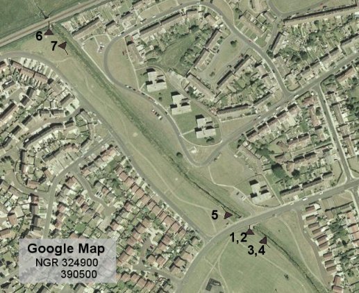
The photo below left (5) is taken from the same road bridge but looking north (downstream). Three hundred metres further north, the brook passes under the West Kirby to Liverpool railway line. The picture below right (6) shows the railway culvert itself is nice and clear but upstream of the culvert is as choked as it appears to be - as you can see from the photo bottom right (7) looking back upstream (south) from the railway culvert.
|
|
 |
|
OK, it's time to put the serious walking boots on and see how well I can follow the path of the brook.....